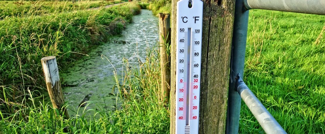
Did you know… an El Niño year could increase global temperatures?
Scientists are predicting that there is a 66% chance we will pass the 1.5C global warming threshold between now and 2027. This is in part due to the world officially entering an El Niño phase, according to the US science agency NOAA. The weather patterns seen during El Niño include increased global temperatures as they did in 2016, the hottest year on record. With higher than average temperatures, thunderstorms, hail and flash flooding reported in most areas of the UK this week including Surrey, we take a closer look at what El Niño means for our future.
The weather pattern known as El Niño is actually one part of the natural climate phenomenon called the El Niño Southern Oscillation (ENSO). There are two states which both have a significant impact on global weather. The two states are called El Niño and La Niña. The El Niño weather pattern that has been observed this year is typically determined based on the sea surface temperatures of the tropical eastern Pacific. If the temperature of this ocean rises to at least 0.5C above the long-term average then scientists know that there will be changes to global atmospheric circulation which allows them to predict potential upcoming weather and climate effects.
What we know already is that a vast body of warm water has been making its way across the tropical Pacific Ocean towards South America. This has triggered an El Niño weather pattern and is set to strengthen as we continue through 2023. The pattern can also have longer term effects into the first few months of 2024 so it is not just our current weather events that will be impacted by this phenomenon. If scientists are correct about the El Nino conditions they are saying this, alongside rising emissions, is leading to a 66% chance that the world will break through a key 1.5C global warming threshold at least one year between 2023 and 2027.
El Niño and La Niña episodes typically occur every two to seven years, and usually last nine to 12 months. They don’t follow a pattern and La Niña events are typically less common than El Niño. However, in the past few years the Northern Hemisphere had three La Niña episodes in a row between 2020 and 2022 which was a very rare ‘triple dip’. This is thought to have reduced the impact of climate change on the global temperature but the EU’s climate monitoring service reported that 2022 was still the fifth warmest year on record. That’s why a return to El Niño conditions is such an important factor when we are looking at global temperatures and climate change.
What can we expect from an El Niño weather event?
There are common effects that can be seen with an ENSO weather event. They are not uniform and no years have been exactly the same. The consequences vary across the globe of course but scientists have observed some common effects across temperature, precipitation, tropical storms, and carbon dioxide levels. Here are the four main ways the world is affected by this weather event:
Temperature – What scientists typically see during an El Niño episode is an increase in global temperature (whereas the temperature usually falls during a La Niña event). The hottest ever year on record was in 2016 which was an El Niño year. Scientists know that warmer water travels further and also rises closer to the surface of the ocean. This releases more heat into the atmosphere and creates warmer and wetter air.
Precipitation – The Pacific jet stream’s strong air currents are pushed by warmer waters to the south and east which brings much wetter weather to the southern USA and the Gulf of Mexico, whereas tropical regions like southeast Asia, Australia, and central Africa usually experience drier conditions during this time.
Tropical storms – There are generally more tropical storms in the tropical Pacific, but less in the tropical Atlantic during an El Niño pattern.
Carbon dioxide levels – The warmer and drier conditions in tropical conditions are thought to have an impact on the plants and our CO2 levels. In drought conditions plants will grow slower and therefore absorb less carbon dioxide. If wildfires are caused by higher drier temperatures then more CO2 will be released into the atmosphere also.
It’s not entirely clear how our local temperatures and weather will be affected by El Niño as the climate impact is more greatly felt and predictable in the Asia-Pacific regions. Scientists find it more challenging to establish the impact across the North Atlantic-Europe sector and it is a topic of ongoing research. Previous studies do show significant climate impact for Europe and in particular a cold anomaly in northern Europe and a warm anomaly in southern Europe and Turkey during winter. The consequences of this event for the weather in the UK are said to be linked to a risk of colder winters in Britain and hotter-than-average summers. The effects of El Nino actually often peak during December which is why we may feel the effects when it comes to the winter season of 2023 and into early 2023.

Whilst we might be welcoming the warmer weather here in Surrey over the past week or so, we are aware now more than ever of the impact of increasing temperatures on our daily lives, the countryside, and the world at large. There are concerns that as carbon emissions continue to rise, future El Niño events might tip global temperatures above the 1.5C threshold more and more often.
According to a recent study by the University of Exeter limiting long-term global warming to 1.5C would mean five times fewer people live in dangerous heat and would help prevent climate-related migration and detrimental health outcomes. Dangerous heat is defined as an average temperature of 29C or higher and can be associated with pregnancy loss and impaired brain function according to the study. Co-author of the study and director of the Global Systems Institute at the University of Exeter, Tim Lenton says,
“Every 0.1C really matters. Every 0.1C of warming we can avoid, by our calculation, is saving 140 million people from exposure to unprecedented heat and the harms that could come with it. It’s saving hundreds of millions of people from harm and that should be a huge incentive to work harder to get to zero emissions.”
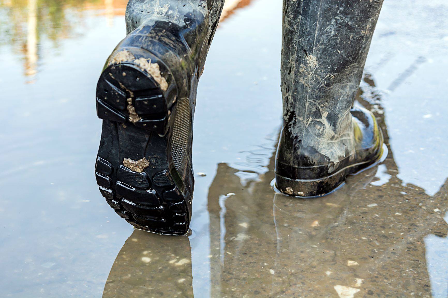
Climate change is one of the biggest threats facing our countryside.
One of the biggest threats to Surrey’s countryside comes from the climate and ecological emergency. Wildlife habitats are at risk, and many of our native species face extinction. The climate emergency is degrading the natural environment, resulting in the loss of soil fertility and biodiversity. At CPRE we’re concerned about the fragility of our vital eco-systems and believe that protection of Surrey’s countryside requires a firm commitment to tackling climate change.
We work collaboratively with our partners through the Surrey Climate Commission and the South East Climate Alliance to address the impact of the climate and ecological emergency on our local countryside, and showing how our local countryside and green spaces can play a key role in mitigating and adapting to the effects of climate change.
Find out more and how you can get involved.